All posts by David Pottinger

Five Fascinating Fleet Pond Facts

a1940-drained-pond-1940-1

Michelle Salter writes:

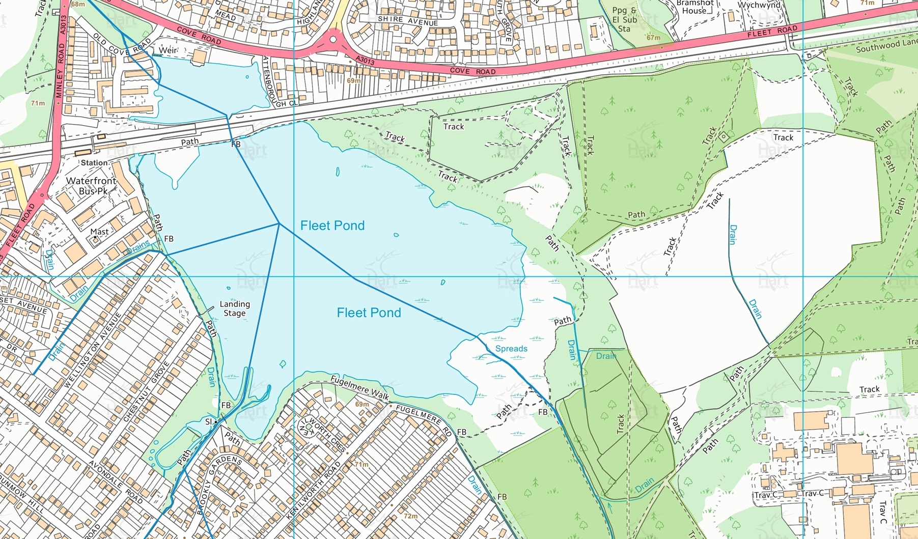
How old is the pond? The first clear reference to the pond was in the 14th century, when “the great fishery (of) Fleet Ponds” is referred to in the Rolls of Account of Crondall Manor. By this time, there seems to have been a thriving fishery of considerable importance and two ponds.

Do any museums house records of the pond? Many Victorian naturalists visited Fleet Pond and references to its flora frequently appeared in natural history journals from this era, with herbarium sheets located at the Natural History Museum in Kensington and also at Reading and Oxford.

When was the pond used as an ice rink? In the 1840’s, the South Western Railway ran special excursions to Fleet Pond, including a “Skating Specials” in the Winter.

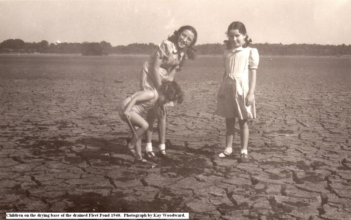
When was the pond, not a pond? In 1940, the MOD completely drained the pond to stop hostile bombers from using it as a landmark to find the Royal Aircraft Establishment at Farnborough (see photo above).

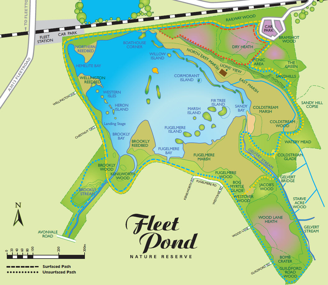
What title did the pond receive in 1951? The pond was designated a Site of Special Scientific Interest in 1951 and was one of the first sites in Hampshire to receive this distinction, due to the importance of the lake to waterfowl and the rich aquatic and heathland flora.

Ed. This article is a repost, it was originally published in October 2008.

Clouds, Trees And Streams

[youtube https://www.youtube.com/watch?v=xXPLbcsDOJQ&w=560&h=315]

I recently came across the video above, it gives a good account of the calming benefits of a nature reserve. We’re so lucky to have one right on our doorstep!

If you would like to support Fleet Pond Society in helping maintain and preserve the Pond, please consider giving a donation (see here for details). It would really be appreciated!

An expansion on the interesting text that accompanies the video above can be found here.

Fascinating Interactive Map Of Fleet

Hart Map Fleet Pond 2

David Pottinger writes:

The other day I was making an online payment to Hart District Council and I noticed that their website now includes a very interesting and helpful interactive map of the area (see the example screenshot above).

The link is here (I’ve found the responsivesness of the site can vary, you may need to try a few times).

Notice that on the lhs you can overlay various criteria. For the picture above I have chosen Planning Information (General) and then Rivers (the blue lines above).

On the top of the map you can also choose Background and this covers aerial imagery from 1997 to 2013.

The online map is also useful if you plan to explore the environs of Fleet Pond, as described in a previous post here.

Anyway, it’s certainly worth a look!

Volunteer Event This Sunday, 13 September

There will be a volunteer event at Fleet Pond this coming Sunday and all are welcome (see below for registering).

Colin Gray, Chairman of Fleet Pond Society, writes:

“Ranger Rachel plans to ensure you all get muddy this Sunday by taking you out into Wellington Reedbed (the one closest to Wellington Road). There will be reed cutting and clearing and scrub cutting to do. Please assemble as usual at the Countryside Workshop, Old Pump House Close, GU51 3DN, at 9.00 a.m.

I recommend wellington boots or waterproof boots for this task. Some sections of the reedbed are firm but there are plenty of squashy areas and some where a boot can go right through the reed mat into very muddy water. As usual a warm drink will be available mid-morning but bring water if you feel you might need a cool drink.

Remember there is very limited parking at the workshop so please park in Kenilworth Road.”

For further information and booking (which is essential as tools and resources have to be planned beforehand), please contact Hart Countryside Services:

Phone: 01252 623443
Email: countryside@hart.gov.uk

The Sunday volunteer tasks are supervised by a Hart Countryside Ranger together with members of Fleet Pond Society.

Details of the programme from September 2015 to March 2016 can be found here.

Exploring Fleet Pond And It’s Environs

2015-07-19_Nature Reserve Walk

A local family taking a walk in the area leading up to Fleet Pond

David Pottinger writes:

One of the most popular articles on this blog is the one that describes three walks (short, medium and long) that you can take around Fleet Pond. The walk details are given here and are illustrated in the map below (see the red, yellow and blue dotted lines).

Fleet Pond Map 2014

You can of course venture a bit further out and explore the area that corresponds to the RHS of the above map. There are various turnings from the Pond you can take to get there (one is illustrated below, leading up the incline) or else you can start directly from the car park.

2015-07-19_FP Nature Reserve

Of course, a good map of the area would always be helpful to avoid getting lost! However this area seems quite popular and there are often other walkers that you can ask if you get a bit disoriented.

The land actually belongs to the Secretary of State for Defence but the public are permitted to use all parts of it for open-air recreation (with some exemptions). The full details can be found on the various signs dotted around the site (see picture below).

2015-09-03_Defence Lands

To give a flavour, here are some photos of this interesting area that I took a couple of years ago. This corresponds to the upper RHS in the map above; by the way, the train track provides a handy reference for general orientation.

 2013-08-03_01

2013-08-03_02

2013-08-03_03

2013-08-03_04

If you fancy a longer walk some time, or perhaps just something a little different, why not give it a go?

In addition, if it impressed you, perhaps you could leave a review on TripAdvisor? Feedback is really invaluable!